If your ideal day starts with a morning walk, includes easy access to trails, and ends with river views or quiet green space, Mendota Heights deserves a closer look. For many buyers, outdoor access is not just a nice extra. It shapes daily routines, weekend plans, and even which streets feel like the right fit. In Mendota Heights, you get a mix of scenic overlooks, paved regional trails, and neighborhood parks that make it easy to spend more time outside. Let’s dive in.
Why Mendota Heights Stands Out
Mendota Heights is often described by the city as a first-ring suburb with a small-town feel and big-city amenities. What makes it especially appealing for outdoor-minded buyers is how much green space is woven into an established residential setting.
The city reports 17 public parks, Oheyawahe/Pilot Knob, and more than 295 acres of parkland and open space. It also highlights activities like walking, bicycling, bird watching, cross-country skiing, golfing, and nature hiking. That range gives you both everyday convenience and room for bigger weekend outings.
Another helpful sign for long-term buyers is that the city completed a Park System Master Plan in 2025. That tells you the park system is part of an active planning effort, not a static list of amenities.
River Views Define the Setting
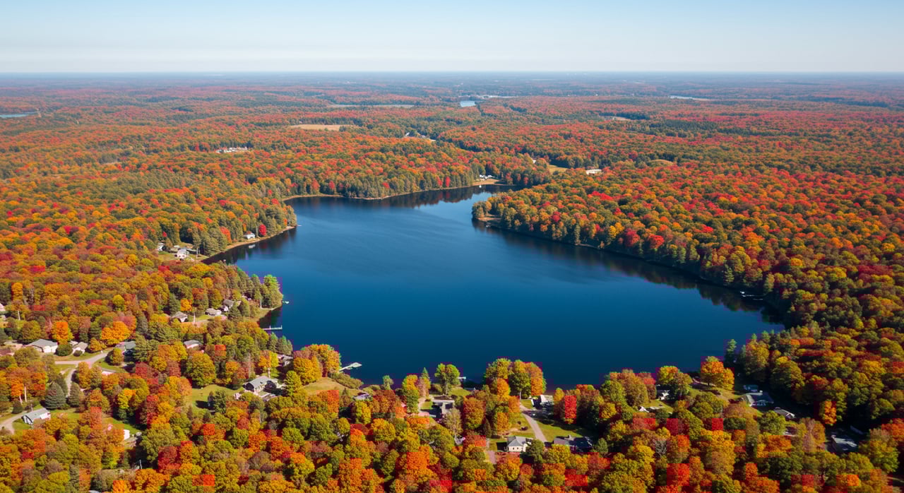
One of the best ways to understand Mendota Heights is to think of it as a bluff-and-overlook city with strong river access nearby. You are not choosing a shoreline community in the traditional sense. Instead, you are choosing a place where elevated views, river corridors, and trail connections shape the outdoor experience.
That matters because the feel of the city is different from a suburb with just a few isolated parks. Here, the landscape itself adds character, especially around the confluence of the Mississippi and Minnesota rivers.
For buyers who value scenery, this creates a compelling mix. You can enjoy broad views, natural areas, and trail systems while still living in an established residential community with practical day-to-day access.
Big Rivers Regional Trail Access
For many outdoor lovers, the Big Rivers Regional Trail is one of Mendota Heights’ strongest assets. Dakota County describes it as a scenic paved trail along the northern edge of Dakota County from Eagan to Lilydale.
The trail overlooks the meeting of the Minnesota and Mississippi rivers and follows an abandoned railroad bed. In Mendota Heights, Dakota County lists a trailhead at 1498 Mendota Heights Road, with added access at Highway 55 and I-35E.
This is the kind of amenity that can elevate your daily routine. A paved regional trail nearby makes it easier to fit in a walk, bike ride, or longer outing without needing to drive across the metro first.
Just as important, the trail connects beyond the city itself. Dakota County notes links to Fort Snelling, Pike Island, the city of Mendota, and the larger river corridor.
River to River Greenway Connections
The River to River Greenway adds another layer to Mendota Heights’ outdoor appeal. Dakota County says this 7.7-mile greenway runs from the Lilydale trailhead of the Big Rivers Regional Trail to Kaposia Landing and the Mississippi River Greenway.
Along the way, it passes through parks, residential areas, and commercial areas in Mendota Heights, West St. Paul, and South St. Paul. That mix makes the route useful for both recreation and everyday movement through connected parts of the community.
Dakota County’s management plan also notes that the corridor is near about 830 acres of natural areas. Those areas include prairies, oak woodlands, forests, and wetlands, which adds variety to the landscape and supports a stronger sense of place.
Oheyawahe and Pilot Knob Views
Oheyawahe, also known as Pilot Knob, is one of the most distinctive outdoor spaces in Mendota Heights. The city describes it as a 112-acre site on the National Register of Historic Places, with 27 acres of public land overlooking the confluence of the Mississippi and Minnesota rivers.
The site is considered sacred by Dakota people, and the city says restoration work is focused on pre-settlement prairie and oak savanna communities. That history and stewardship give the space a different character than a typical neighborhood park.
For visitors and nearby residents, the practical appeal is also clear. The paved walking trail and natural area features make it a memorable place for a scenic walk, a quiet pause, or a simple reset in the middle of a busy week.
Parks That Support Daily Use
Regional trails are a major draw, but Mendota Heights also works well because the local park network supports regular daily use. That is often what turns outdoor access from a weekend feature into a real lifestyle benefit.
Valley Park Amenities
Valley Park is one of the city’s larger park spaces. Located at 821 Marie Avenue, it spans 84.1 acres and includes a youth softball field, tennis courts, an asphalt basketball half-court, a playground, natural areas, and paved walking paths.
The city also notes that its paved walking paths continue from Dodd Road to Highway 13. That extended path network can make the park feel useful for both recreation and simple everyday walks.
Rogers Lake Park Features
Rogers Lake Park adds a broad mix of activities in one setting. The city says the park includes a fishing pier, skate park, basketball court, volleyball, picnic shelters, trails, a playground, paved walking paths, and natural area.
For buyers thinking about how they actually live, this kind of park can matter a lot. It offers options for different ages, different routines, and different kinds of downtime without requiring a major outing.
Smaller Green Spaces Matter Too
Some of the most useful outdoor amenities are the ones close enough to become part of your normal week. Mendota Heights has several smaller natural areas and neighborhood-scale green spaces that help create that convenience.
Copperfield Ponds includes a gravel walking trail between ponds. Friendly Marsh Park offers a paved walking trail, and Valley View Heights Park has a walking path that connects to Wagon Wheel Trail and Rogers Lake Park.
These spaces may not be the headline attractions, but they help explain why Mendota Heights feels livable for outdoor-minded residents. They make it easier to step outside for a quick walk instead of saving nature for the weekend.
What This Means for Homebuyers
If outdoor access is a top priority, location within Mendota Heights can shape your experience in a very practical way. In general, the streets closest to trail nodes, park connections, and walking-path networks may offer the easiest day-to-day access to the features you will use most.
Based on the park addresses and trail connections in the city and county information, several areas stand out. Homes near Pilot Knob Road and Highway 55 are closest to Oheyawahe and the Big Rivers trailhead.
Homes near Marie Avenue west of Dodd Road are closer to Valley Park and the River to River corridor. Homes near Wagon Wheel Trail, Huber Drive, and Cullen Avenue sit near Rogers Lake Park, Copperfield Ponds, Friendly Marsh, and Valley View Heights Park.
That does not mean one area is universally better than another. It means your search may be stronger if you begin with how you want to use the outdoors, then match those habits to the streets and park connections that support them.
A Smart Way to Tour Mendota Heights
If you are considering a move here, try touring Mendota Heights through the lens of your routines. Instead of asking only how a home looks on paper, ask how easily you could walk, bike, or spend time outside from that address.
A few useful questions to keep in mind:
- How close are you to a paved trail or park entrance?
- Would you use the space for quick daily walks, longer rides, or both?
- Do you want scenic overlooks, natural areas, or active recreation nearby?
- Would smaller neighborhood green spaces improve your day-to-day lifestyle?
This approach can help you evaluate value in a more personal way. For many buyers, the right outdoor setting is not just an amenity. It is part of what makes a house feel like home.
Why Buyers Keep Mendota Heights on the List
Mendota Heights offers a combination that can be hard to find in one place. You have river views, strong trail connectivity, and a deep local park network within an established residential city.
That balance is what makes the area appealing for outdoor lovers. You are not limited to destination outings on the weekend, and you are not limited to small neighborhood paths either. You get both, which can make daily life feel more connected to the landscape around you.
If you are looking for a Mendota Heights home that supports how you want to live, work, and recharge, thoughtful local guidance makes a difference. To explore homes and neighborhoods with a more tailored approach, connect with Sally English.
FAQs
What outdoor amenities make Mendota Heights appealing to homebuyers?
- Mendota Heights offers 17 public parks, more than 295 acres of parkland and open space, regional trail access, scenic overlooks, and neighborhood walking paths that support both everyday use and longer outings.
Where is the Big Rivers Regional Trail access in Mendota Heights?
- Dakota County lists a trailhead at 1498 Mendota Heights Road, with additional access at Highway 55 and I-35E in Mendota Heights.
What is Oheyawahe in Mendota Heights?
- Oheyawahe, also known as Pilot Knob, is a historic site with public land, paved walking trails, natural area features, and views overlooking the confluence of the Mississippi and Minnesota rivers.
Which Mendota Heights parks are good for everyday walks?
- Valley Park, Rogers Lake Park, Friendly Marsh Park, Copperfield Ponds, and Valley View Heights Park all offer walking paths or trail connections that can support regular daily outdoor use.
How can outdoor lovers narrow a home search in Mendota Heights?
- A practical first step is to focus on homes near key trail and park nodes, such as areas around Pilot Knob Road, Highway 55, Marie Avenue west of Dodd Road, Wagon Wheel Trail, Huber Drive, and Cullen Avenue.